We publish practical BIM articles for Archicad and Solibri users across the Nordics. Subscribe to Insights and get each new piece as it lands.
The calvulator ritual
You know the routine. A client wants a gentle slope on their new terrace. You pull out the calculator. Distance: 12 meters. Desired fall: 2%. That's 0.24 meters of elevation change. You place your first point at 45.00, your end point at 44.76. You draw a construction line, place intermediate points, check your math twice, then delete the scaffolding.
Three days later, the client moves the terrace 2 meters north. Back to the calculator.
This is "slope math." It's the tedious, repetitive cycle that turns terrain design into an exercise in arithmetic rather than creativity. Every path, every parking area, every graded surface requires the same disconnected process: calculate, draw, verify, delete the scaffolding, repeat.
The frustrating part? You became a landscape architect to design outdoor spaces. Not to be a human calculator.
What if the software did the math?
The core problem with traditional 2D workflows, whether in AutoCAD or basic Archicad Mesh tools, is that nothing is connected. Your spot levels are just points. Your lines are just lines. Change one elevation, and everything downstream requires manual recalculation.
Parametric terrain modeling flips this entirely. Instead of disconnected elements, you work with intelligent objects that understand their relationships. When you modify a "parent" point, all dependent "child" points update automatically. The 3D surface regenerates itself. The slopes stay correct.
This isn't a minor workflow improvement. It's a fundamental shift from drafting terrain to designing it.
Gradient interpolation: the tool that eliminates slope math
Here's where it gets practical. LAND4 for Archicad includes a feature called Gradient Interpolation. The name is technical. The function is simple: you tell the software what slope you want, and it calculates every elevation for you.
Let's walk through a real scenario:
The parking lot problem
You're designing a parking area that needs proper drainage. In traditional CAD, this means calculating dozens of spot levels to achieve a consistent 0.5% fall toward the drainage outlet. Every point requires its own calculations. Miss one, and you've got a puddle waiting to happen.
With LAND4, the process looks different:
1. You place your first Spot Level at the edge of your path next to the parking. LAND4's Gravity Tool snaps it to the existing pavement surface automatically.
2. You specify your desired slope: 0.5% fall toward the drainage point.
3. You start placing additional Spot Levels across the parking area and other drainage points.
Here's the key difference: every point you place is automatically calculated to the correct elevation. No calculator. No temporary construction lines. No scaffolding to delete. The software handles the arithmetic while you focus on the design intent.
The sidewalk that updates itself
Now extend the scenario. On the street side, a sidewalk connects to your parking area. In a traditional workflow, the sidewalk's starting elevation depends on where the parking lot ends. Change the parking lot, and you're recalculating the sidewalk from scratch.
With LAND4, the final point of your parking area becomes the starting point for your sidewalk. You apply a new Gradient Interpolation, perhaps a 2% fall for accessibility compliance, and the sidewalk generates itself.
The real power shows up when the client changes their mind. Adjust the parking lot elevation by 10 centimeters? The sidewalk's starting point updates automatically. All downstream elevations recalculate. Your slopes stay correct. Zero rework.
The system behind the magic
Gradient Interpolation doesn't work in isolation. It's part of a larger system of intelligent objects that work together.
Spot Levels are the foundation. These aren't just points with XYZ coordinates. They're smart objects that carry elevation data and understand their relationships to other elements.
Ridge Lines define the hard edges in your landscape. Curbs, retaining walls, pathway edges. Holding elevation data, they force the 3D model to triangulate correctly along these features, so your terrain will conform to detailed shapes.
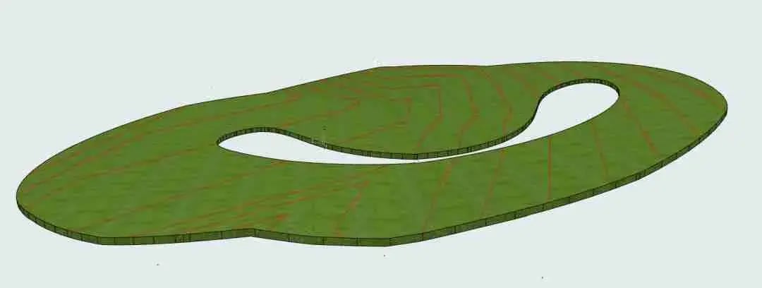
LANDSurface is the dynamic 3D terrain model that is generated dynamically from your Spot Levels and Ridge Lines. In 2D plan view, it's built on Archicad's native Fill tool. If you know how to draw a fill in Archicad, you already know how to define a terrain’s plan shape.
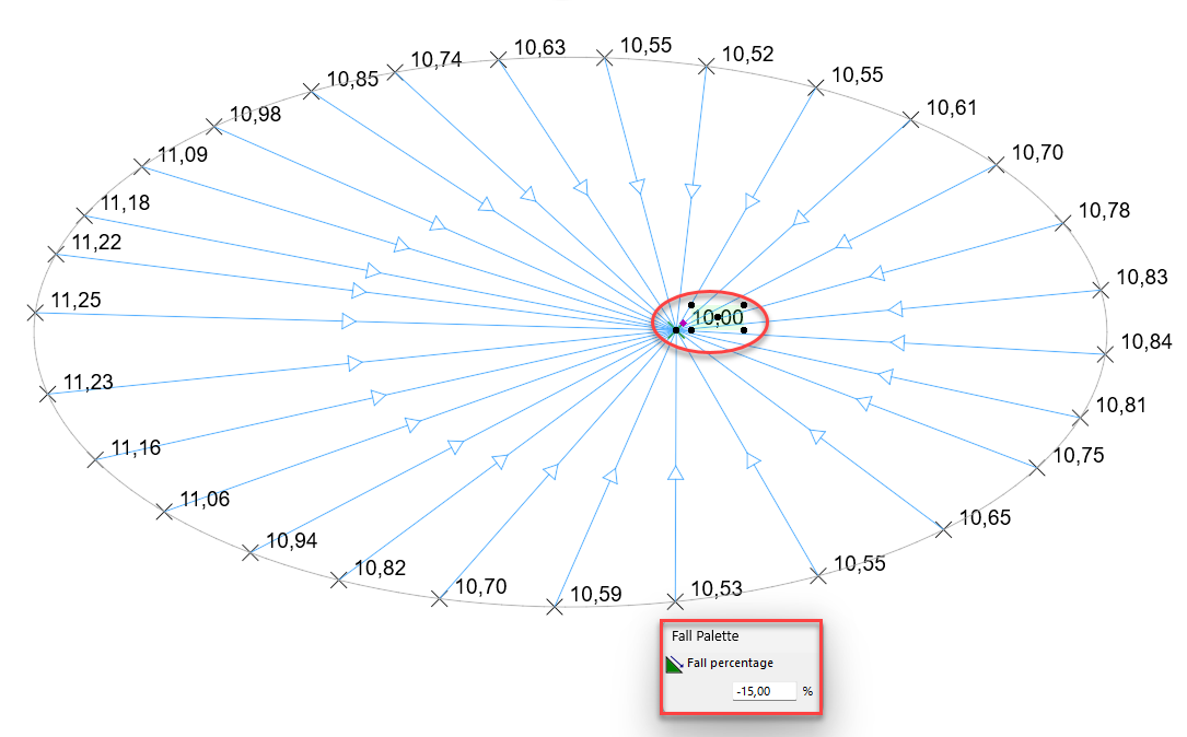
Fall Lines provide instant visual feedback. These arrows display slope direction and exact percentage directly on your 2D plan. They update in real-time as you modify the terrain. No more hoping your drainage is correct. You can see it.
What you get back
The value proposition is straightforward. By automating the repetitive calculations, LAND4 returns time to you. Time you can spend on design decisions that actually require human judgment: material choices, spatial relationships, aesthetic refinement, client collaboration.
There's also the error reduction. Manual calculations invite mistakes. Automated calculations don't forget to carry the one.
And there's the competitive angle. BIM deliverables are increasingly expected in the Nordic market. Working in a true parametric model environment positions your practice for projects that require more than flat CAD drawings and or a separate visualisation modelling.
See it work
Reading about slope automation is one thing. Watching a parking lot generate itself with correct drainage in real-time is another.
If you're tired of the calculator ritual and ready to spend more time designing and less time doing arithmetic, request a personalized demo. We'll walk through Gradient Interpolation using scenarios from your actual projects.